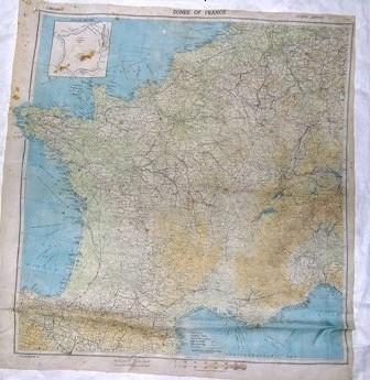
Map [Escape Map 'Zones of France']
Production date
Mar 1944
See full details
Object detail
Accession number
2004.43
Production period
Description
Silk, escape map. Zones of France Second Edition, Scale: 1:2,000,000. The longitude East of Greenwich is 0° to 9°. The West border is the English Channel. The North areas are Belgium and Holland. The South border is Spain. The map provides main roads, secondary roads, special motorways, main railways, other railways, frontiers 1.5.9 (WEA) MARCH 44. There is an index in the top, left corner giving an outline of the frontiers.
Marks
1.5.9 (WEA) MARCH 44 Inscribed
1:2,000,000/ ZONES OFFRANCE/ SECOND EDITION Inscribed
1:2,000,000/ ZONES OFFRANCE/ SECOND EDITION Inscribed
Media/Materials
Collection
Credit Line
Mar 1944. Map [Escape Map 'Zones of France'], 2004.43. The Museum of Transport and Technology (MOTAT).


Public comments
Be the first to comment on this object record.