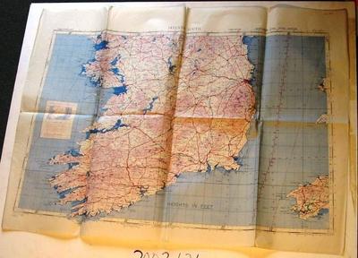
Map - Ireland South
Object detail
Accession number
2003.434
Description
Map - paper - Ireland South Third Edition Northern Zone Layer System - N.W.51½/11. Geographical Section General Staff No.4072, published by War Office 1940. Compiled and drawn at War Office 1940.
Marks
IRELAND SOUTH / NORTHERN ZONE LAYER SYSTEM / ("LAYER STEPS CORRESPOND TO THOSE ON THE R.A.F. CONVENTIONAL SIGN CARD") / THIRD EDITION / N.W.51 1/2 /11 / Geographical Section, General Staff, No. 4072. / Published by War Office 1940. / 3rd Edition 1943. / 50,000/8/44 A. / Projection. Europe (Air) Conical Orthomorphic (Central Zone) / Compiled and drawn at War Office 1940. Heliographed at Ordnance Survey 1940. Printed
Media/Materials
Credit Line
Map - Ireland South, 2003.434. The Museum of Transport and Technology (MOTAT).


Public comments
Be the first to comment on this object record.