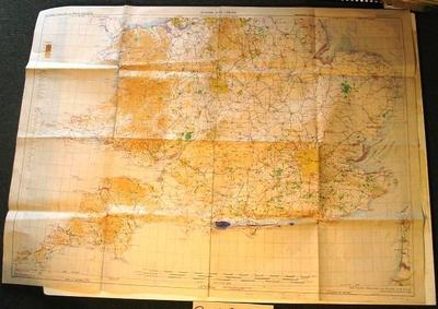
Map - Southern England and Wales
Object detail
Accession number
2003.415
Description
Map - paper - Southern England and Wales (N.W. 50/5½) Europe ICAO Geographical Section General Staff, No. 4649, published by War Office 1948. Compiled, drawn and reproduced by OS 1948.
Marks
EUROPE ICAO 1:500,000 / SOUTHERN ENGLAND AND WALES (N.W. 50/5½) / PROVISIONAL EDITION / CONICAL ORTHOMORPHIC PROJECTION / PARALLEL OF ORIGIN 51°30' / STANDARD PARALLELS 53° 58'36" & 48° 58'37" / Geographical Section, General Staff, No.4649 / Published by War Office 1948. / SOUTHERN ENGLAND AND WALES (N.W. 50/5½) / Compiled, drawn and reproduced by O.S. 1948 / Aeronautical information Sept. 1948 / Danger Areas are not shown on this chart Printed
SALES COPY / PRICE 5/- Ink Stamp
HURN-DUNSFOLD. / Track = 068 (T) +low = 078 / Distance = 54 nautical miles Hand-written
SALES COPY / PRICE 5/- Ink Stamp
HURN-DUNSFOLD. / Track = 068 (T) +low = 078 / Distance = 54 nautical miles Hand-written
Media/Materials
Credit Line
Map - Southern England and Wales, 2003.415. The Museum of Transport and Technology (MOTAT).


Public comments
Be the first to comment on this object record.