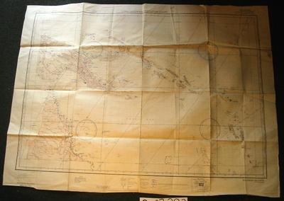
Map - Solomon Islands
Object detail
Accession number
2003.383
Description
Map - paper - Solomon Islands Restricted. Compiled by US Army Air Forces, by the Army Map Service, US Army Washington DC. Authorities US Hydrographic Office Charts Nos. 2022, 2027, 2179, 2896, 2897, 2899, 2941, 2942.5593. Aeronautical date: May 1942. Long range Air Navigation Chart Solomon Islands (note maps on both sides of the document).
Marks
LONG RANGE AIR NAVIGATION CHART / SOLOMON ISLANDS / Solomon Islands, Port Moresby Area and New Britain New Ireland, / Espiritu Santo, Efate, Utupua, Vanikoro and Santa Cruz Islands / SOURCES / U.S. Navy Hydrographic Office Charts, Nos., 1985, 2882, 2883, 2896, 2943, 2948. Printed
Compiled for the U.S. Army Air Forces, by the Army Map Service, U.S. Army, Washington, D.C. / AUTHORITIES / U.S. Hydrographic Office Charts, Nos. 2022, 2027, 2179 / 2896, 2897, 2899, 2941, 2942, 5593. / Map of Australia, 1:6,000,000. / Isogonic Lines, Hydrographic Office Isogonic Chart No. 2406, 1940. / Aeronautical Data, May 1942 / ARMY MAP SERVICE, U.S. ARMY, WASHINGTON, D.C., 105213 / 1942 / REVISION 11-42 Printed
Compiled for the U.S. Army Air Forces, by the Army Map Service, U.S. Army, Washington, D.C. / AUTHORITIES / U.S. Hydrographic Office Charts, Nos. 2022, 2027, 2179 / 2896, 2897, 2899, 2941, 2942, 5593. / Map of Australia, 1:6,000,000. / Isogonic Lines, Hydrographic Office Isogonic Chart No. 2406, 1940. / Aeronautical Data, May 1942 / ARMY MAP SERVICE, U.S. ARMY, WASHINGTON, D.C., 105213 / 1942 / REVISION 11-42 Printed
Media/Materials
Credit Line
Map - Solomon Islands, 2003.383. The Museum of Transport and Technology (MOTAT).


Public comments
Be the first to comment on this object record.