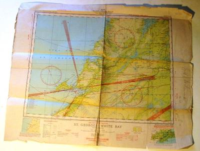
Map - St. Georges-White Bay, Canada
Object detail
Accession number
2003.374
Description
Map - paper - Map Sheet 12 SE. Air Navigation Edition St. Georges - White Bay Newfoundland. Produced in cooperation with the Crown Lands and Surveys Branch of the Department of Natural Resources, Newfoundland. Date of Publication: December 17th, 1942. Canada Department of Mines and Reuters. National Topographic Series. There is a series of handwritten navigation numbers with a graph pencilled on the back.
Marks
Canada / Department of Mines and Resources / SURVEYS AND ENGINEERING BRANCH / HYDROGRAPHIC AND MAP SERVICE / NATIONAL TOPOGRAPHIC SERIES SHEET 12 S.E. / AIR NAVIGATION EDITION / ST. GEORGES - WHITE BAY / NEWFOUNDLAND / Compiled, drawn and printed at the Hydrographic and Map Service, / Labelle Building, Ottawa, 1940, where additional copies may be obtained. Printed
Media/Materials
Credit Line
Map - St. Georges-White Bay, Canada, 2003.374. The Museum of Transport and Technology (MOTAT).


Public comments
Be the first to comment on this object record.